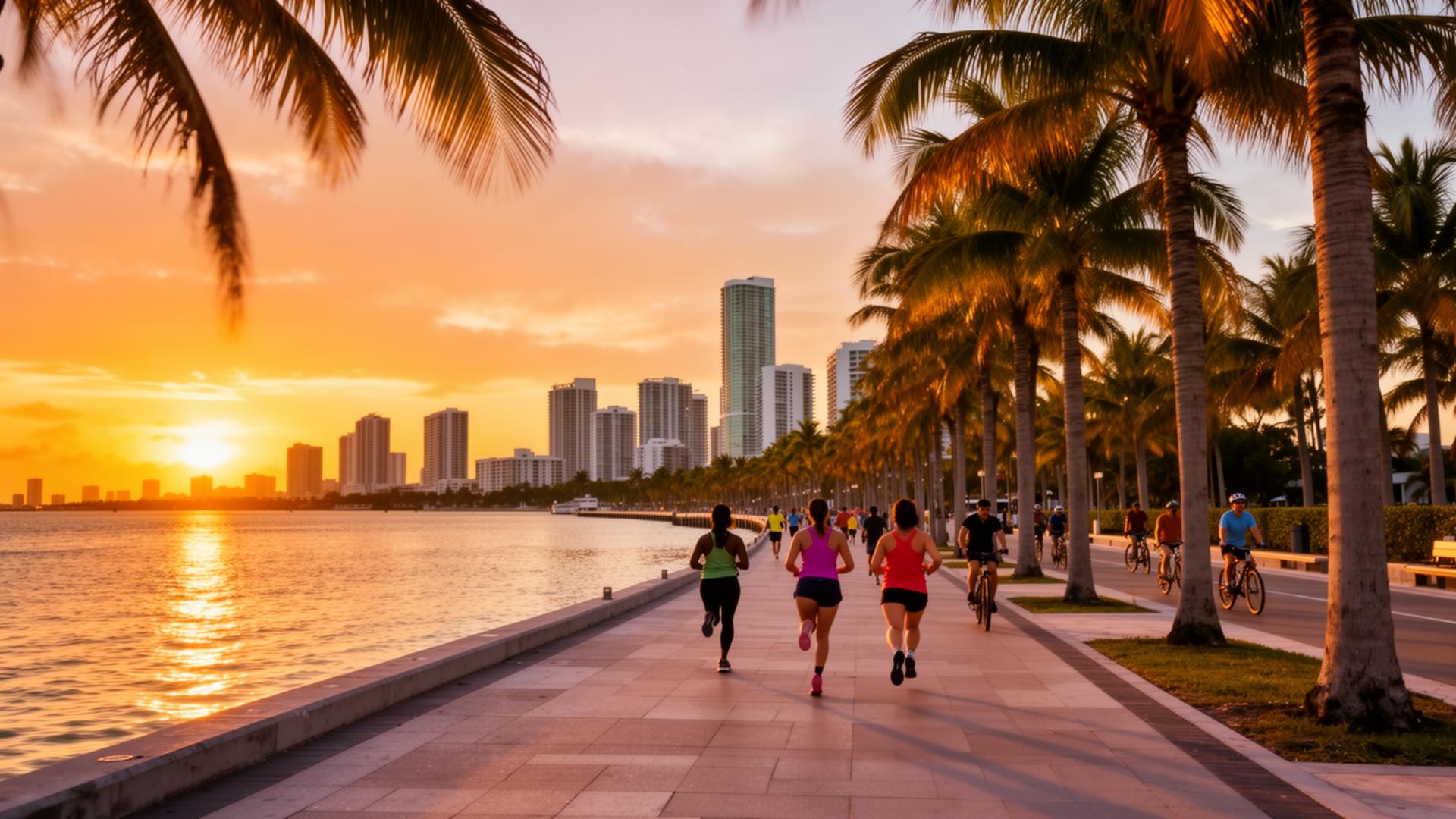
A guide to Miami's jogging and cycling trails
If you want the most useful Miami jogging and cycling trails for a daily routine, start with five that anchor the map: The Underline beneath the Metrorail, the Commodore Trail through Coconut Grove, the Rickenbacker Causeway out toward Key Biscayne, the Venetian Causeway across Biscayne Bay, and the Miami Beach Beachwalk along the ocean. Each connects to a distinct set of neighborhoods, which matters if you are weighing where to live around an active routine. The Underline is a 10-mile linear park running from the Miami River in Brickell to the Dadeland South Metrorail station [1]. The Commodore Trail covers roughly 5.4 miles along Coconut Grove's waterfront [2]. The Rickenbacker Causeway gives you the closest thing to sustained hill work in a flat region, thanks to the climb over the William M. Powell Bridge. Below is how each trail actually runs, the verified distances, and the parts of Miami that sit within reach of them.
Last updated: June 2026
The Underline: a linear park under the Metrorail
The Underline is a 10-mile linear park and shared-use path built in the corridor beneath Miami-Dade's elevated Metrorail. It runs from the Miami River in the Brickell area south to the Dadeland South Metrorail station [1]. The first phase, the Brickell Backyard, opened in February 2021; a second 2.14-mile segment opened in April 2024, and the remaining 7.36-mile section was under construction toward completion in 2026 [1].
The appeal for a runner or cyclist is continuity and access. Because it follows the Metrorail, you can ride or run a stretch and take the train back, which makes one-way routes practical. The corridor links Brickell toward Coral Gables and South Miami, so it is worth factoring into a search if you want an urban base with a dedicated path at the door.
The Commodore Trail: Coconut Grove's waterfront route
The Commodore Trail follows Coconut Grove's waterfront for roughly 5.4 miles, running along South Bayshore Drive and Main Highway and passing landmarks including Vizcaya Museum and Gardens, Kennedy Park, Peacock Park, and the Barnacle Historic State Park [2]. It is a mix of paved path and sidewalk sections shaded in places by mature tree canopy, which makes it a manageable choice in Miami's heat.
The trail sits in the heart of Coconut Grove, one of the older and more walkable parts of the city. If you are evaluating a home along this corridor and want to understand current value, the listing valuation tool is a starting point before you talk pricing.
The Rickenbacker Causeway: bridge climbs toward Key Biscayne
The Rickenbacker Causeway connects mainland Miami to Virginia Key and Key Biscayne. The causeway itself runs about 3.6 miles, including roughly 1.2 miles of bridge structure, and it carries one of the busier running and cycling routes in Miami-Dade County [3]. The continuous trail extends farther south along Crandon Boulevard, so riders often log a longer out-and-back across Virginia Key toward Crandon Park.
The draw is the William M. Powell Bridge, whose grade gives cyclists a repeatable climb in an otherwise flat region, with skyline views at the top. Wide shoulders run alongside the roadway. The causeway is the land link to Key Biscayne, an island community where a number of residents fold the bridge into a regular training loop.
The Venetian Causeway: a flat crossing of Biscayne Bay
The Venetian Causeway runs roughly 2.8 miles across Biscayne Bay, linking mainland Miami to Miami Beach through a chain of islands by way of a series of low bridges. The route has dedicated green bike lanes and minimal elevation change, which makes it an accessible option for newer riders and a steady tempo route for everyone else.
Because it lands you in Miami Beach, the causeway is a practical commuter and recreation path at once. Traffic moves more slowly here than on the larger causeways, which is part of why it draws so many cyclists, joggers, and walkers.
The Miami Beach Beachwalk: an oceanfront promenade
The oceanfront path on Miami Beach, the Beachwalk, runs along the Atlantic for several miles between South Pointe Park and the North Beach area. The City of Miami Beach describes it as a continuous oceanfront pedestrian promenade, and most riders and runners cover the stretch from South Pointe up toward 79th Street and beyond [4].
It is busy with foot traffic during the day, so early mornings tend to be the better window for a continuous run or ride. The path runs the length of Miami Beach, which means much of the barrier island sits within a short walk of uninterrupted ocean views.
Old Cutler Road and Oleta River: two more to know
Two routes round out the picture. Old Cutler Road runs south from Coconut Grove through Coral Gables and toward Cutler Bay, lined with mature canopy and passing Matheson Hammock Park and Fairchild Tropical Botanic Garden. It is a scenic road ride rather than a separated trail, so cyclists share the lane and ride with traffic awareness.
For off-road riding, Oleta River State Park in North Miami Beach offers more than 10 miles of mountain bike trails plus about 3 miles of paved trail through mangrove and bayfront terrain. It is the main destination in the area for unpaved riding and is reachable from Aventura and the north end of the county.
Practical notes for trail use
Miami's heat and humidity drive most of the planning here. A few points worth keeping in mind:
- Carry water. Humidity speeds fluid loss; plan routes near public fountains or bring your own.
- Run early or late. Sunrise and the hour before sunset avoid peak heat and the heaviest road traffic.
- Light up for night riding. On shared roadways like Old Cutler and the causeways, bright front and rear lights matter.
Proximity to a trail is one of the practical lifestyle factors buyers weigh alongside commute, schools, and price. If you are mapping a search around a daily route, a buyer consultation is a useful place to line up neighborhoods against your priorities.
Frequently asked questions
How long is The Underline in Miami?
The Underline is a 10-mile linear park running beneath the Metrorail from the Miami River in Brickell to the Dadeland South Metrorail station. It is being built in phases, with the final 7.36-mile section under construction toward completion in 2026 [1].
Which Miami trail is best for cycling hills?
The Rickenbacker Causeway is the most common choice for climbing repeats, because the William M. Powell Bridge provides a sustained grade in an otherwise flat region. The causeway runs about 3.6 miles and the connected trail continues south toward Crandon Park [3].
Are these trails safe to ride with traffic?
It varies by route. The Underline and the Beachwalk are separated shared-use paths. The Venetian Causeway has dedicated bike lanes. Old Cutler Road and parts of the Rickenbacker run alongside vehicle traffic, so lights, visibility, and lane awareness matter more there.
Where can I mountain bike near Miami?
Oleta River State Park in North Miami Beach has more than 10 miles of mountain bike trails plus roughly 3 miles of paved path, making it the primary off-road riding destination in the area.
Which neighborhoods sit closest to a major trail?
Brickell connects directly to The Underline, Coconut Grove sits on the Commodore Trail, Key Biscayne is reached via the Rickenbacker Causeway, and Miami Beach is served by both the Venetian Causeway and the Beachwalk.
Gabriel
Sources
- Miami-Dade County - The Underline
- Friends of the Commodore Trail - Who We Are
- Miami-Dade County - Rickenbacker Causeway
- City of Miami Beach - Beachwalk
Gabriel A. Moyers, PA. eXp Realty. Florida License #3407280. Equal Housing Opportunity. This article is general information as of June 2026 and is not legal, tax, or financial advice. Verify current figures against authoritative sources before acting.
Thinking of selling your luxury property in Miami? Find out what your home is worth.
Get Your Home ValuationLooking for your dream home in Miami? Take our personalized home search quiz.
Start Your Home Search Quiz