
 Price Improved
2 bd 2.5 ba 1,023 sf
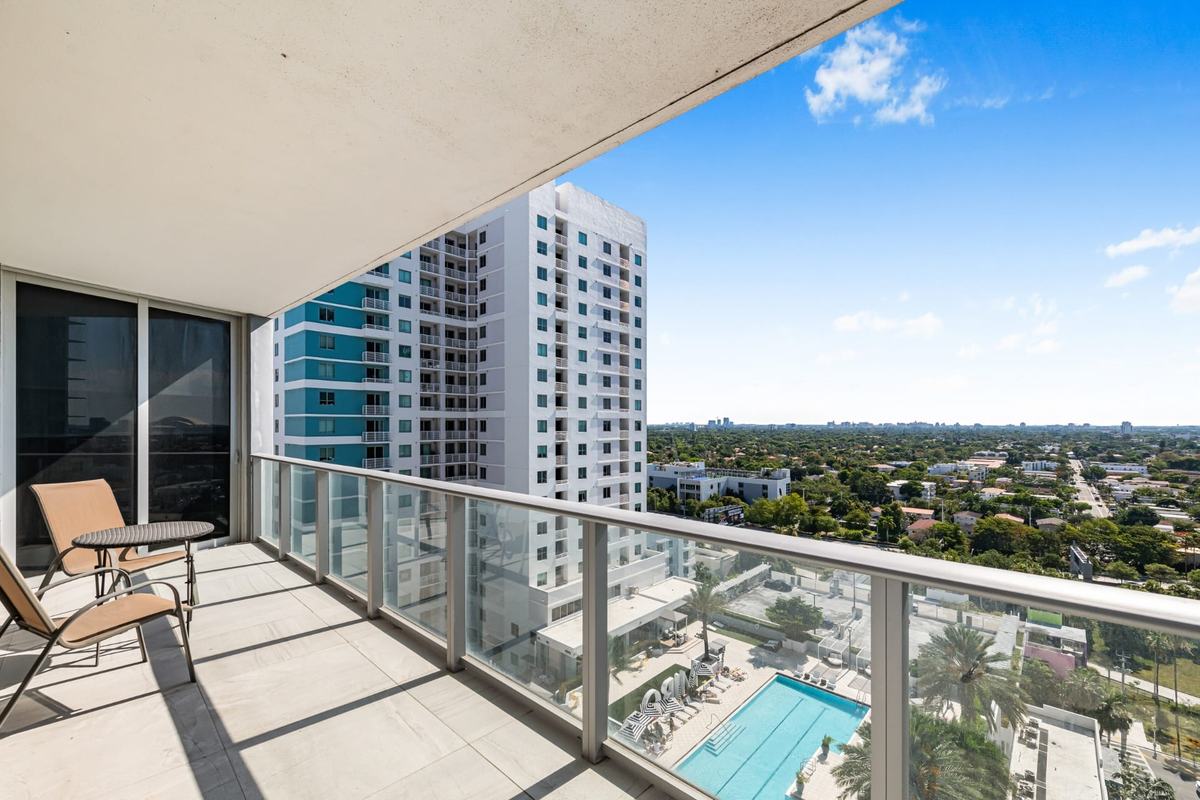
Brickell Ten condo residence, 2BR/2.5BA on the 16th floor, built 2016. MLS A12021849.
View this property68 SE 6th St, Miami, FL 33131 (Reach) and 88 SW 7th St, Miami, FL 33130 (Rise)
Two condominium towers within the Brickell City Centre development, which also includes retail, hotel and office space.
Facts retrieved September 24, 2026; sales counts updated October 30, 2026. Numbers in brackets link to the sources at the bottom of the page.
| Tower | Address[1] | Residential units[5][6] | Stories[8][16] | Year built[1] | Qualified sales[1] |
|---|---|---|---|---|---|
| Reach | 68 SE 6th St | 390 | 43 | 2016 | 39 |
| Rise | 88 SW 7th St | 390 | 43 | 2016 | 47 |
| Total | 780 | 86 |
Residential units are the developer's counts. The Property Appraiser roll has 390 residential unit records at Reach and 389 at Rise, plus one common-area record per tower (unit SCU, owned by the association since January 2026, with no bedrooms). Stories are the developer's count; the Skyscraper Center counts 44 floors at Reach and 45 at Rise. Sales are qualified sales recorded between Sep 2024 and Aug 2026.[1][3][4][5][6]
Reach amenities as listed on the official Brickell City Centre residences page (archived January 2021). The official Rise pages describe only the amenity deck. The amenity decks of Reach and Rise total nearly one acre. Confirm current amenities and services with each association.[6][7][16]
On FEMA's 2009 map, in effect through February 18, 2027, both tower parcels are in Zone AE, with a base flood elevation of 9 ft (NGVD29).[9][10][11]
Zone AE is one of FEMA's special flood hazard areas, where FEMA sets a base flood elevation. The zone is set for the building site, not for individual units.
FEMA flood map panel 12086C0314L, effective September 11, 2009.
On FEMA's 2027 map, effective February 19, 2027, both tower parcels are in Zone AE, with a base flood elevation of 8 ft (NAVD88).[9][10][11]
FEMA's 2009 flood map for Miami-Dade County is in effect through February 18, 2027, and its new map is effective from February 19, 2027. Check the map in effect at the FEMA Map Service Center before you buy.[9][10][11]
The 2009 map gives base flood elevations in feet above NGVD29 and the 2027 map in feet above NAVD88. In Miami-Dade a NAVD88 figure is about 1.5 ft lower than the NGVD29 figure for the same height, so compare the zones, not the numbers.[12]
FEMA map source (National Flood Hazard Layer): Reach, 2009 map query, Rise, 2009 map query, Reach, 2027 map query, Rise, 2027 map query.
How this is measured: the shortest pedestrian route on OpenStreetMap (OSRM foot profile) from the Property Appraiser parcel point to the station location published by Miami-Dade County. Distance from a building entrance to the platform will differ.
86 qualified sales recorded by the Miami-Dade Property Appraiser between Sep 2024 and Aug 2026 (recording lags about two months).[1]
By tower: Reach 39, Rise 47.
How this is counted: sales of the 780 residential units in the two towers that the Property Appraiser flags as qualified (arm's-length) with a price above zero, counted once per unit, date and price. Corrective deeds, quitclaim deeds and other non-qualified transfers are left out. The count is public-records context, not a valuation of any unit.
Tell Gabriel what you are looking for. He sets up an MLS search for you, and every new listing that matches is emailed to you straight from the MLS, including price changes. No account to create, and you can stop the emails at any time.
Prefer to talk it through? Call or text (305) 342-3206
Gabriel A. Moyers, PA · eXp Realty, LLC · FL Lic. #3407280 · Equal Housing Opportunity
Price ImprovedBrickell Ten condo residence, 2BR/2.5BA on the 16th floor, built 2016. MLS A12021849.
View this propertyRequest a Two-Comp Basis Brief. Gabriel picks two comparable recorded sales, sets them against what you paid, and prepares the brief personally.
Gabriel A. Moyers, PA · eXp Realty, LLC · FL Lic. #3407280 · Equal Housing Opportunity
The Two-Comp Basis Brief is a comparative market analysis prepared by a licensed real estate agent. It is not an appraisal.
Public records and published sources, retrieved September 24, 2026 (sales counts updated October 30, 2026). Where sources differ, this page says so and names the source of each figure. This is an independent guide by Gabriel Moyers. It is not affiliated with or endorsed by the developer, the condominium association, building management or any brand named on this page.
Miami-Dade Property Appraiser, GIS parcel layer
Unit folios for the Reach and Rise condominiums (folio prefixes 01-4138-167 and 01-4138-168): year built, situs addresses, the common-unit (SCU) records and recorded sales. Retrieved September 24, 2026. Sales re-counted October 30, 2026.
Skyscraper Center (Council on Vertical Urbanism, formerly CTBUH), Reach
Floors, height and architect.
Skyscraper Center (Council on Vertical Urbanism, formerly CTBUH), Rise
Floors, height and architect.
Swire Properties, Reach
Developer's page: 390 units at Reach and interior design by Richardson Sadeki.
Brickell City Centre residences page, Rise (archived February 23, 2024)
Official residences page: the two towers within the development and a nearly one-acre amenity deck, described for Reach and Rise together.
The Real Deal, January 28, 2016
Both towers described as 43 stories, in coverage of the developer's new renderings.
FEMA National Flood Hazard Layer, flood hazard zones
Flood zone and base flood elevation for the Property Appraiser parcel. FEMA flood map panel 12086C0314L, effective September 11, 2009, is in effect through February 18, 2027. Its replacement, panel 12086C0314M (issued as preliminary on February 25, 2021 and made final on August 19, 2026), is effective from February 19, 2027 (FEMA's pending map layer, checked October 29, 2026). Base flood elevations on the 2009 panel are in feet above NGVD29 and on the 2027 panel in feet above NAVD88. On the 2027 panel both tower parcels are Zone AE (coastal floodplain, base flood elevation 8 ft NAVD88) throughout. Retrieved September 24, 2026.
Federal Register, FEMA, Final Flood Hazard Determinations (October 14, 2026)
FR Doc. 2026-20917, docket FEMA-B-2166: the flood hazard determinations for Miami-Dade County and its incorporated areas, including the City of Miami, have been made final, and February 19, 2027 is the effective date set for the new flood insurance rate map. Retrieved October 29, 2026.
FEMA, communities with new flood maps effective February 19, 2027 (Letter of Final Determination list)
FEMA's list for the Letter of Final Determination dated August 19, 2026: FIRM effective date February 19, 2027, for Miami-Dade County and its communities, including Miami (City, Miami-Dade), community number 120650. Retrieved October 29, 2026.
FEMA, datum conversion points for the new Miami-Dade flood maps (pending map layer)
Conversion from NGVD29 to NAVD88 for the Miami-Dade study (DFIRM 12086C): a NAVD88 figure is 1.55 ft lower at longitude 80.25 W and 1.56 ft lower at 80.125 W, latitude 25.75 N, the points either side of Brickell. The 2009 map's base flood elevations are in feet above NGVD29 and the 2027 map's in feet above NAVD88. Retrieved October 29, 2026.
Miami-Dade County GIS, Metromover and Metrorail station layers
Station names and locations. Retrieved September 24, 2026.
Miami-Dade Department of Transportation and Public Works, Metromover map (August 2026)
Current station names, including Brickell City Centre (Eighth Street), which the county's GIS station layer still lists as Eighth Street. Retrieved September 24, 2026.
OSRM walking routes on OpenStreetMap data (FOSSGIS routing service)
Shortest pedestrian route (foot profile) from the Property Appraiser parcel point to each station point.
Brickell City Centre residences page, Reach (archived January 27, 2021)
Official residences page: Reach amenities and floor plans through Level 43. The live site was unavailable on September 24, 2026.
Reach at Brickell City Centre, association website
The association's site. Its documents are behind a resident login. Retrieved September 24, 2026.
Rise at Brickell City Centre, association website
The association's site. Its documents are behind a resident login. Retrieved September 24, 2026.
Gabriel A. Moyers, PA · eXp Realty, LLC | FL License #3407280 | Equal Housing Opportunity